Shibuya · Harajuku · Yoyogi / PLACE
Yoyogi Park
A city park with wooded walks and a central field in Area A, sports and events across the road in Area B.
Use it to change the density of the day, choosing a walk or an event rather than adding another compulsory stop.
Visit fitFor adding outdoor time between shops. Choose an indoor destination if rain, heat or event restrictions make the park unsuitable.
Woodland and open grounds retain traces of the 1964 Olympic village within present-day public life.
Choose the area and gate first so the map’s representative point does not send you to the wrong side.
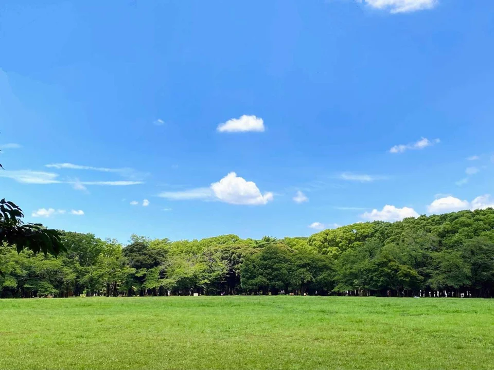
Image info
Tokyo Metropolitan Park Association · resized and croppedWoodland, open grass and water
Begin a first walk in Section A, north of the dividing road. Woodland paths open onto the central lawn and fountain pond. At the bird sanctuary, fruiting trees attract birds behind a protective fence; observation is from outside. The park authority also identifies one surviving building used by the Netherlands team in the 1964 Olympic village. These are concrete stops beyond simply crossing the grass.
WHERE · On foot from here
How far from the station, and which side
South-west of Harajuku Station, about 100 m in a straight line from the station area. The shaded areas are about 5 and 10 minutes on foot from here.
Walking bands are computed by FOW on the OpenStreetMap surface street network at 80 m/min and drawn as a smoothed approximate area around the streets reached. They ignore exit positions, station interiors, underground passages, signals, slopes and routes inside buildings — not directions; follow on-site signs.
Map data: © OpenStreetMap contributors (ODbL) · Walking bands: computed by FOW · Station and gate notes: official guidance (2026-10-16)
Choose a gate and an ending
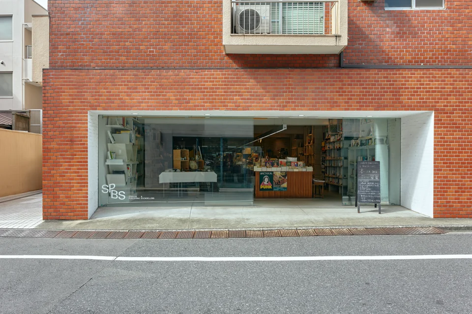
From the Harajuku side, use signs for Harajuku Gate, walk toward the central lawn, then orient around the pond. South Gate and West Gate serve different Tomigaya destinations. Little Nap's stand to the northwest makes a coffee ending; SPBS in Kamiyamacho makes an indoor bookshop ending to the south. Allow an estimated 45–75 minutes for this free walk rather than trying to circle every gate.
Cycling has its own timetable
Section B, across the road, holds sports grounds and the outdoor stage. Cycling uses the designated course and rental centre, rather than all pedestrian paths. The authority's published map lists 09:00–16:30, last rental at 16:00, Monday closure or the following day after a Monday holiday, and ¥210 for an adult bicycle's first hour. Verify the rental notice for the day because map-era fees may change. The general park is continuously open; facilities, events and weather restrictions are separate.
Read it with
Before you go
- Hours and fees
- 2-1 Yoyogikamizonocho. Ordinary park entry is free and continuously open. Cafés, sports facilities and events have separate hours and fees; follow visit-day weather and event controls.
- Good to know
- Weather and event controls can change the route. The locator represents the wider park, not an entrance.
Sources · image info
- Time Out Tokyo · Yoyogi ParkTime Out Tokyo · as of 2026-10-05
- Tokyo Parks:Yoyogi general accesswww.tokyo-park.or.jp · as of 2026-10-19
- Tokyo Parks:Yoyogi barrier-free mapwww.tokyo-park.or.jp · as of 2026-10-19
- Tokyo Parks: Yoyogi Park · as of 2026-10-19
- Tokyo Parks: Yoyogi visitor map · as of 2026-10-19
- Yoyogi Park — Tokyo Metropolitan Park Association · resized and cropped
- SHIBUYA PUBLISHING & BOOKSELLERS — SPBS operator · resized and cropped
- Le Cabaret — Hanako · resized and cropped